Posted on

Mount Laguna

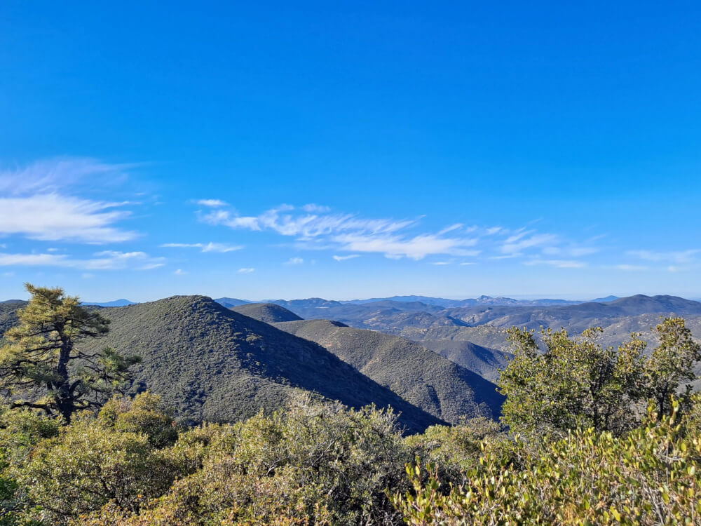
Mount Laguna area in December
White observatory in foreground of dawn rising behind silhouetted mountains.
SDSU Observatory at Mt Laguna

The early morning view from Mt Laguna is inspiring. Light bends at the horizon to create prismatic colors orange, green, and blue. The blue of the sky becomes deeper further up into the atmosphere. Having telescopes there makes sense because of the dark skies far from city lights.

Mt Laguna is a favorite winter play spot for people from San Diego just an hour west by car. The altitude makes for colder nights and sometimes snow. The air is dry and clear so it is easy to see for a long distance. From this height and direction you can see Arizona and Mexico.

My painting is a studio painting because the light was changing fast. I wanted to include the telescope / Observatory to create interest in the composition. Also a nod to my father who built motor drives for telescopes at Kitt Peak and Mt Lemon in Tucson where I grew up. He worked for the University of Arizona but moved to Tucson after the Navy in San Diego. He may have spent some time at Mt Laguna Observatory.

Here’ the layout and the painting.

Five minute sketch for journal of observatory scene to paint in studio at a later time.
Layout of Values and Color Notes
Mt Laguna Observatory watercolor painting

If you have Google Earth installed on your computer, you can visit this location at https://earth.app.goo.gl/?apn=com.google.earth&isi=293622097&ius=googleearth&link=https%3a%2f%2fearth.google.com%2fweb%2f%4032.84441267,-116.44367935,2045.45556288a,0d,35y,102.33302563h,88.75721883t,0r The red line is the Pacific Crest Trail. The Peak is Mt Laguna.

screenshot of Google Earth terrain view of treed mountains rising to peak with map icons floating in scene
Google Earth Looking Easterly

Posted on

Anacapa Island

Anacapa Island with sunshine behind it creating a silhouette that looks like a whale.

The core of me is art. I want to be an artist – a good artist. The mission of this trip is to paint en plain air on a regular basis, daily if possible. It took three weeks for me to reach the point where I could sit in front of my landscape subject and draw and paint. In getting here, I was met with logistical challenges, mental and physical challenges.

For the first en plain air location I chose a desolate location with complex topography and simple colors. Desolate because I fear people looking over my shoulder. Not because it matters but because it challenges my confidence. Much like public speaking, your ideas, talent, and personality are on display and open to criticism.

Anacapa Island is volcanic rock with a little dirt spread like frosting on the top. It is a critical navigation point opposite Ventura marking the west side of the Santa Barbara Channel. In fact, Anacapa is the furthest east island of The Channel Islands an holds a functional lighthouse.

Distant lighthouse at peak of highest hill on Anacapa Island, CA.
Anacapa Island Lighthouse

While painting on location,, what I realized is that I could map the shadows to help create an authentic character of the scene. I drew what I could see for shadow shapes and later filled those in with my near darkest values. Here’s the photograph when I began drawing my pencil outlines of shapes.

Photograph of south side of Anacapa Island cliffs exposed to sunlight.
South Anacapa – photo of watercolor painting position

I mentally assigned values between 1 and 10 to the top of the sky, horizon sky, ocean, shadowed ocean, sunlit land, and shadowed land.

Mixing colors with Nita Engle’s pallete of reds, blues and yellows turned out to be intuitive because she has thought through and practiced the most frequent color mixing. Here’s the result. Not a masterpiece but it captures the scene. This plein air painting was done in three hours including set-up and under drawing.

Watercolor painting of south side of Anacapa Island cliffs exposed to sunlight.
South Anacapa – watercolor en plein air

If you have Google Earth installed on your computer you can visit this location at https://earth.app.goo.gl/?apn=com.google.earth&isi=293622097&ius=googleearth&link=https%3a%2f%2fearth.google.com%2fweb%2f%4034.0109181,-119.37578355,-0.80644256a,1062.93184534d,35y,-112.97140112h,82.10455027t,360r The cliffs are amazing and dramatic in Google Earth.

screenshot of Google Earth terrain view of cliffs in Yosemite Park. Keyhole Rock map icon.

Posted on

Southern Border California

I began Day One of this trip at the southern border of California. Not the prettiest place and a little scary parked overnight in a shuttle bus under the watch of the border patrol.

Southern Border Mosaic Art

Earlier that day I stood at Cabrillo National Monument looking across San Diego Harbor to Imperial Beach and Tijuana, which share the border of California, the beginning of my journey. How do I turn the beauty of a view like this into art? Am I in over my head?

Blue sea and sky over San Diego Harbor taken from Coronado Point.
View of Imperial Beach & Tijuana